CAVE
valley
|
|
CAVE valley |
|
|
| ||
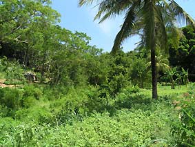
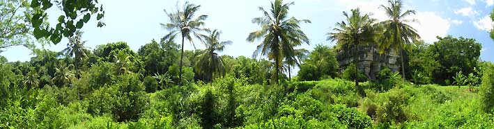
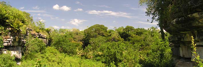
It is all about a plot which is surrounded by caves at a river located only a few kilometers from Tanga, the second biggest port of Tanzania. The valley lies on the South side of the Mkulumuzi river in between the cliffs which are full of unexplored caves. This picture was taken from the shore of the North side of the river bank in South direction showing the coconut palms which are indicating the border of the property. Below the palms or in between the point of view and the visible slope runs the river.
|
| |||||||||||||||||||||||||
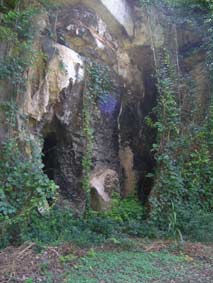
| The Southern part of the river is by far not explored for tourism, but the cave system opposite the river is open for the public. This entrance to the cave has been recently cleared from dense bush - many more can not be seen due to the plants. |
| ||||||||||||||||||||||||
|
| |||||||||||||||||||||||||
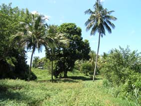 |
Directly above the shore of the South river bank of the property the plains have been cultivated due to its high fertility soil. Best place for agriculture irrigation! 95 meter width along the river! | ||||||||||||||||||||||||
|
| |||||||||||||||||||||||||
Viewed down the valley from the Southern end of the property where due to the narrow standing cliffs the property is much slimmer. Please check out the cavevalleysketch below which shows you how the property is located in the area.
| |||||||||||||||||||||||||
|
Photographed from the Northeast corner of the property at the river. From this point the plot stretches 190 meters in the interior the Southeast border. On the other side from the Northwest corner to the Southwest point the border line is 126 meters long. |
| ||||||||||||||||||||||||
|
| |||||||||||||||||||||||||
|
|
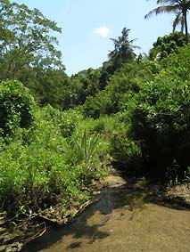
Standing directly in the river, this photograph demonstrates the clear sweet water of the Mkulumuzi river which comes out to the Usambara mountains and furthermore you can see the dense green vegetation at the bank of the stream. | ||||||||||||||||||||||||
|
| |||||||||||||||||||||||||
|
Cavevalley sketch will give you a good overview of the whole area including a part of the caves, the river and of course the property. Please click on the blue link or on the small sketch on the right hand side to view the full sketch.
|
| ||||||||||||||||||||||||
|
| |||||||||||||||||||||||||
|
|
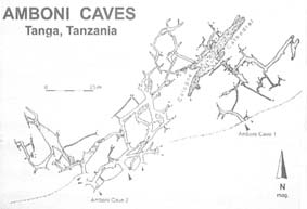
Cave map shows you the extent of the whole explored cave and tunnel system, but the unexplored parts are of course much bigger. | ||||||||||||||||||||||||
|
| |||||||||||||||||||||||||
|
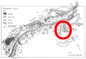
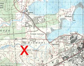
And the topographical map of the area shows you how close the property is located towards the Indian Ocean and to Tanzania's North coast center Tanga.
|
|
||||||||||||||||||||||||
|
|
|||||||||||||||||||||||||
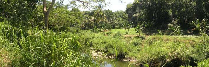
This picture was taken from the Northern bank of the river on the Western side of the property. The Mkulumuzi river can be crossed by foot all through the year without any problems. Unfortunately no efforts have been made yet to construct a bridge towards the property.
| |||||||||||||||||||||||||
| |||||||||||||||||||||||||
|
| |||||||||||||||||||||||||
|
P. O. Box 105 200 Dar es Salaam/Tanzania FAX 002 55 22 2701317
| |||||||||||||||||||||||||